Large detailed maps of South America
See also our maps of North America


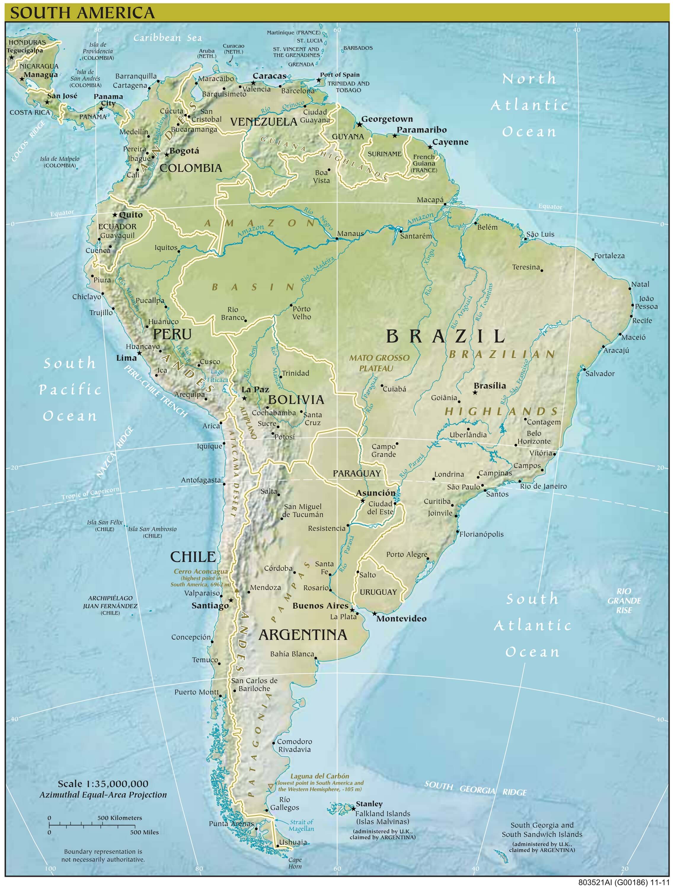
Physical map of South America

Download: JPG (908 x 1200 pixels) | JPG (2271 x 3000 pixels) | JPG (4257 x 5624 pixels) | PNG | PDF
Description: Large physical map of South America, with countries, capitals, cities, mountains and rivers.
License: Royalty free
Author: US Government, Central Intelligence Agency
Source file: The World Factbook 2020 Central Intelligence Agency.
Description: Large physical map of South America, with countries, capitals, cities, mountains and rivers.
License: Royalty free
Author: US Government, Central Intelligence Agency
Source file: The World Factbook 2020 Central Intelligence Agency.
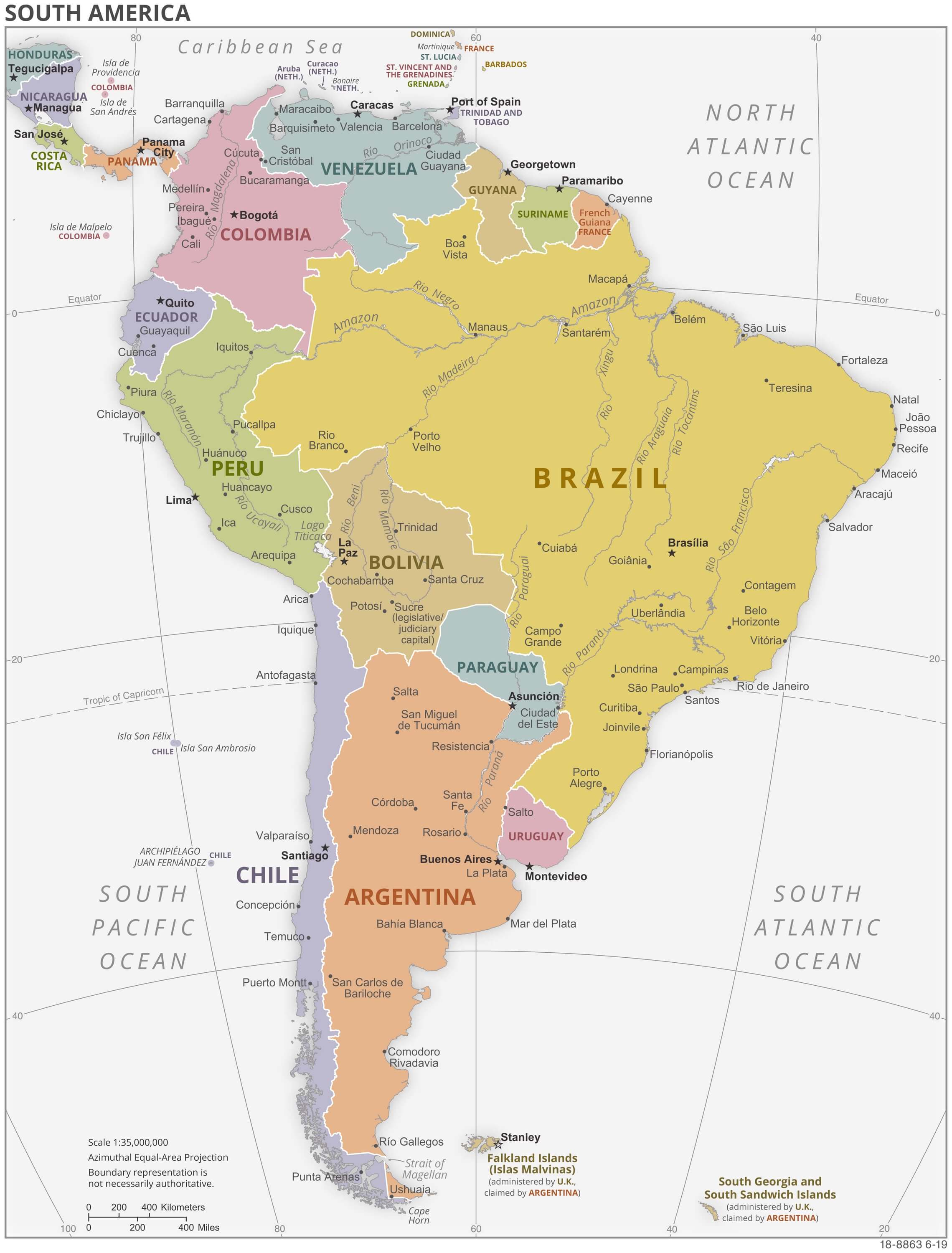
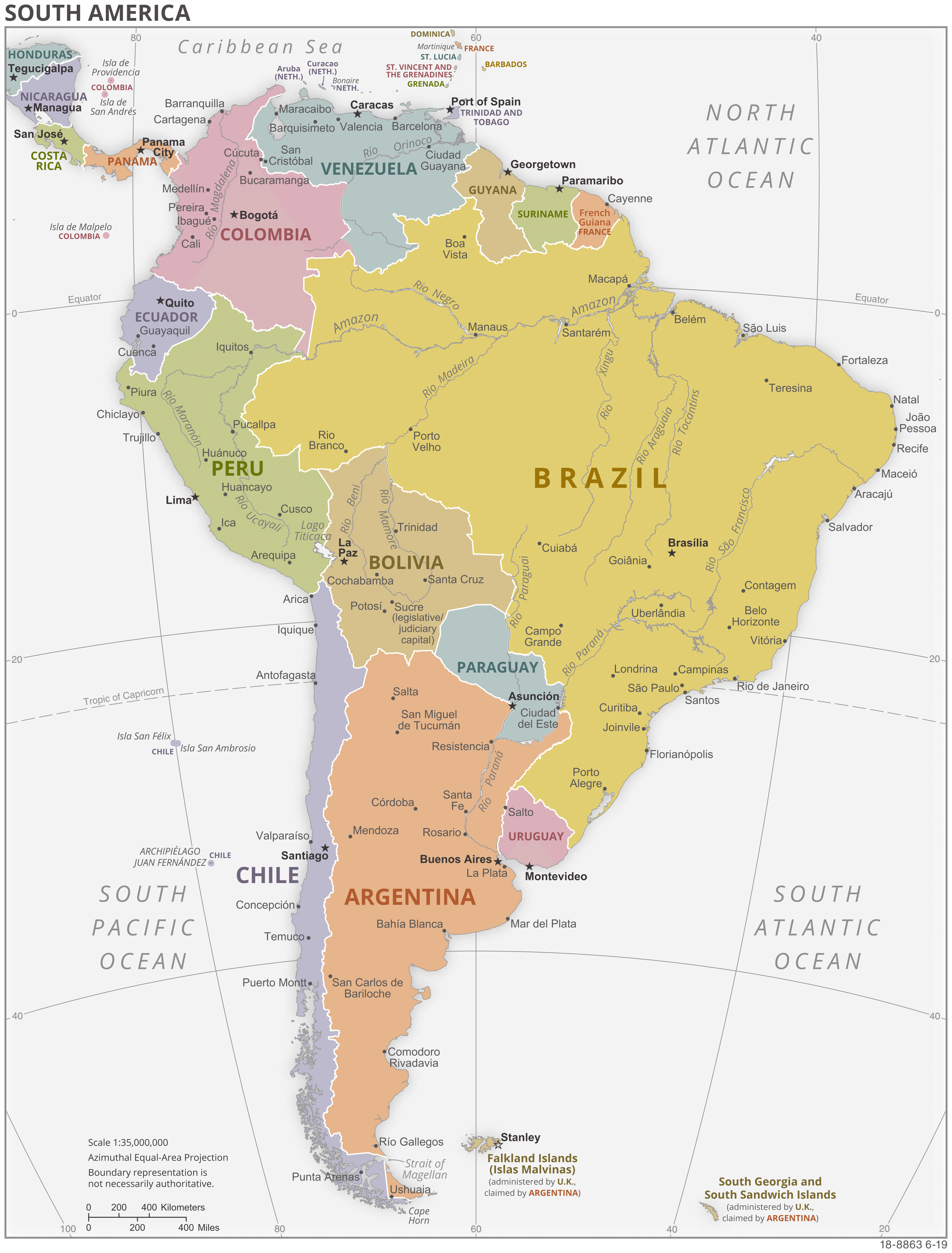
Political map of South America

Download: JPG (912 x 1200 pixels) | JPG (2279 x 3000 pixels) | JPG (4240 x 5581 pixels) | PNG | PDF
Description: Large political map of South America, with countries in color, capitals of each country, major cities and rivers.
License: Royalty free
Author: US Government, Central Intelligence Agency
Source file: The World Factbook 2020 Central Intelligence Agency.
Description: Large political map of South America, with countries in color, capitals of each country, major cities and rivers.
License: Royalty free
Author: US Government, Central Intelligence Agency
Source file: The World Factbook 2020 Central Intelligence Agency.
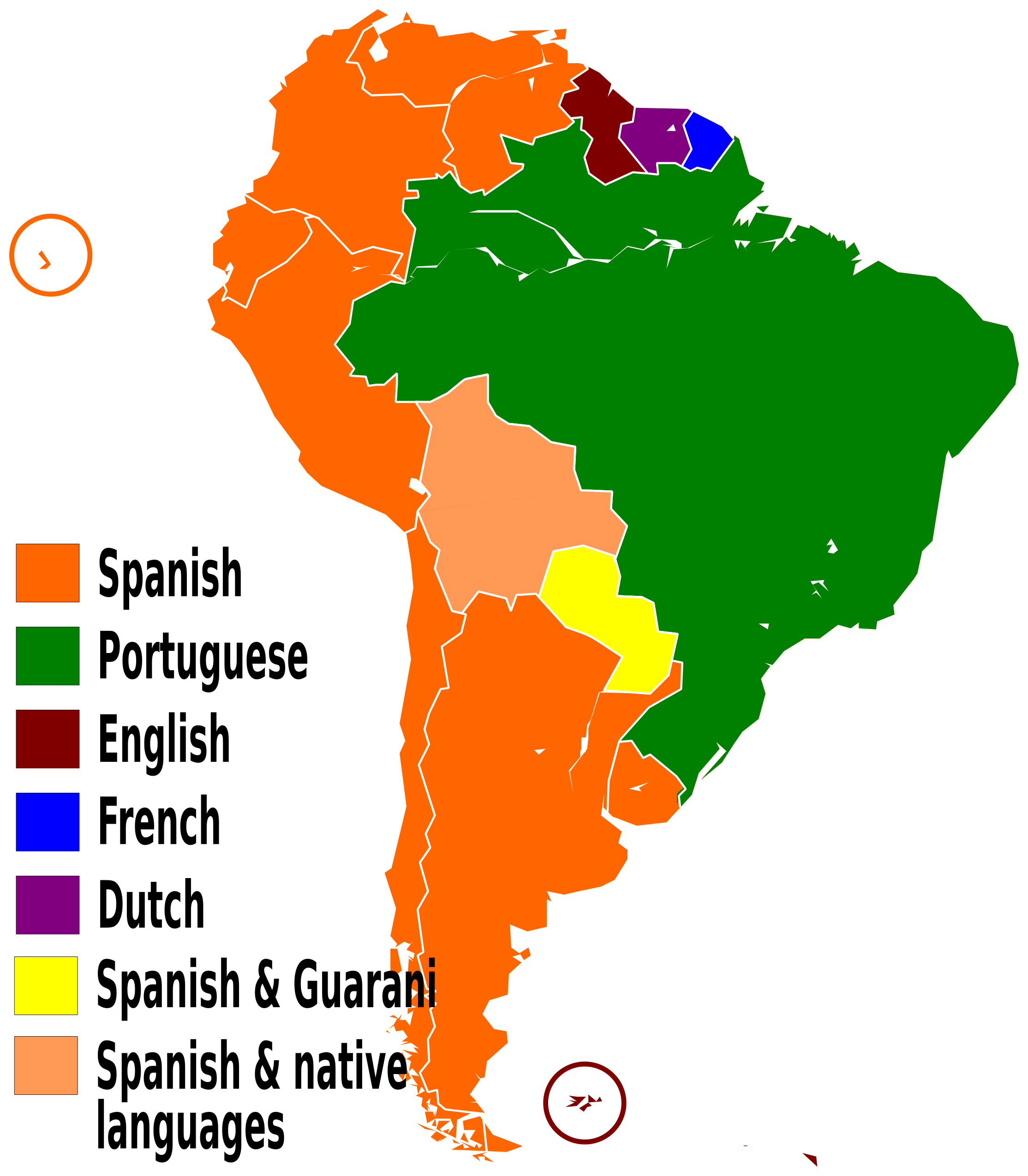
Map of South America with languages spoken

.svg)
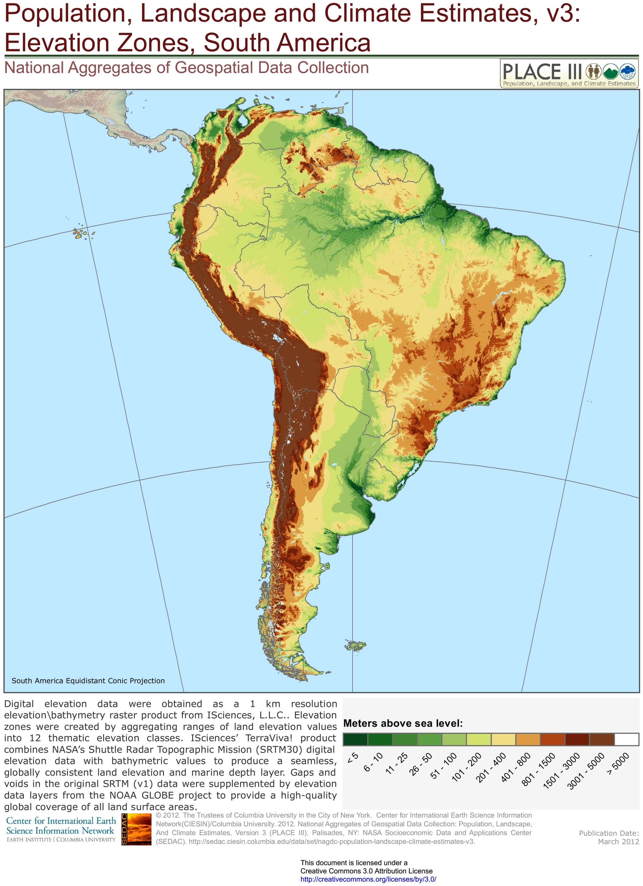
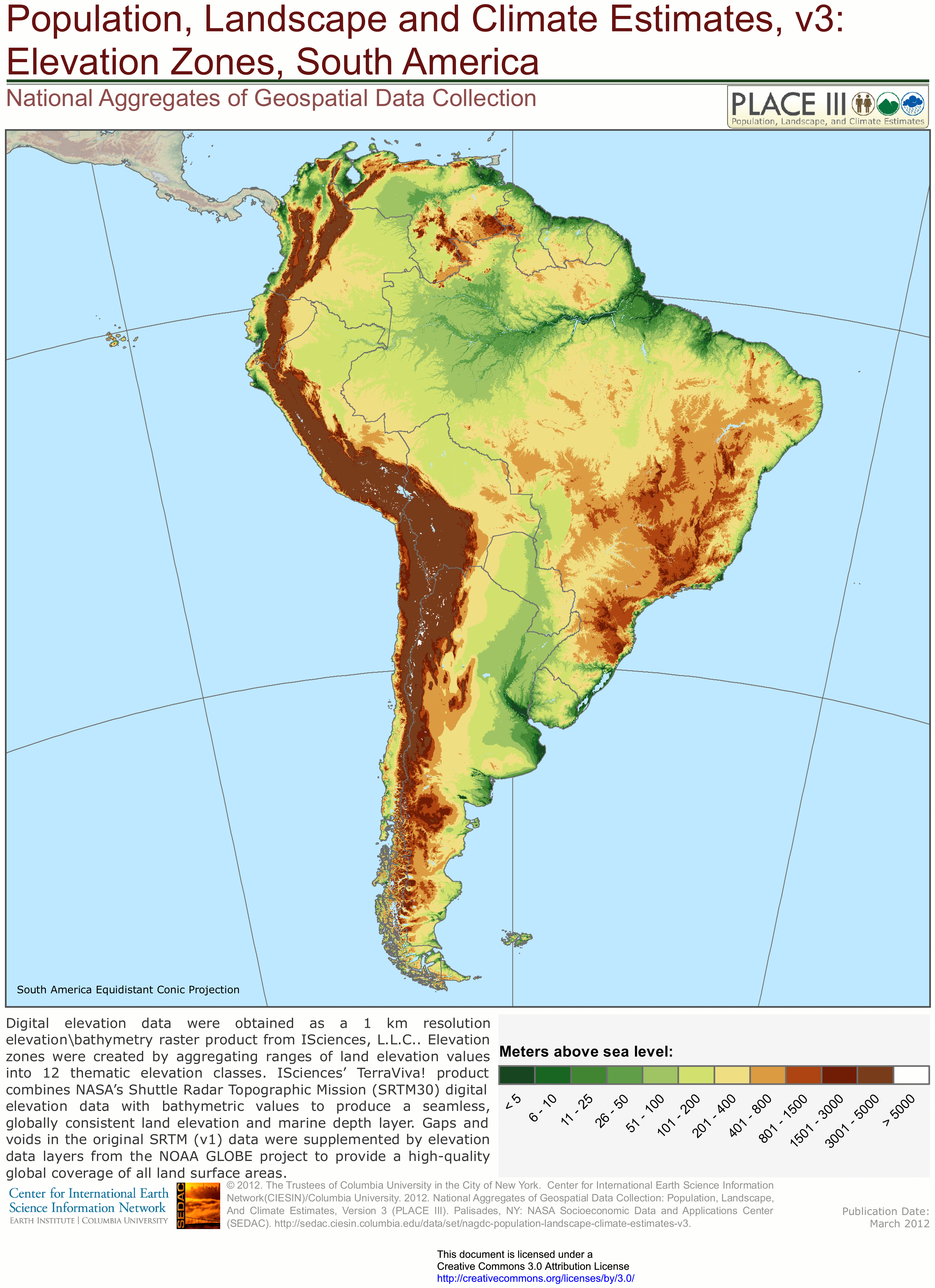
Map of South America with relief and altitude

Download: JPG (871 x 1200 pixels) | JPG (2177 x 3000 pixels) | JPG (4552 x 6274 pixels) | PNG | PDF
Description: Map of South America with relief and altitude in meters and lakes in light blue.
License: CC BY 3.0
Author: Center for International Earth Science Information Network (CIESIN)
Source file: Columbia University of New York (SEDAC)
Description: Map of South America with relief and altitude in meters and lakes in light blue.
License: CC BY 3.0
Author: Center for International Earth Science Information Network (CIESIN)
Source file: Columbia University of New York (SEDAC)